This blog post is part of “YOUR COMPLETE GUIDE TO THE NORTH GEORGIA OUTDOORS” blog series.
How do you plan to experience the beauty of northern Georgia during your next vacation?
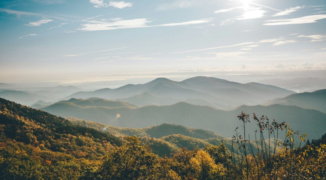
Because we’re lucky to have our own piece of the scenic Blue Ridge Mountain range within our vicinity, many travelers who stay in north Georgia choose to make hiking a part of their vacation itinerary.
Home to spectacular forests, whitetail deer and wild turkey, and cascading waterfalls, each of the many trails located throughout the range has something remarkable to offer those who venture across them.
If you’re ready to see firsthand all that northern Georgia has to offer, you’d better strap on your hiking boots, take out your camera, and get ready for the journey of a lifetime.
Aska Adventure Trail Area
Address: 101-199 Shady Falls Rd, Blue Ridge, GA 30513
No matter what the season, visitors to Georgia won’t want to miss out on the opportunity to hike, bike, and play in the Aska Adventure Trail area.
Located northwest of Helen, in the heart of the Blue Ridge Mountains, this area encompasses 17 miles of trails, ranging from 1-5.5 miles each. Depending on the trails that you choose to tread, you may reach heights up to 3,200 feet in elevation, affording you incredible vistas of the surrounding mountain ridges, the shores of Lake Blue Ridge, vast forests, and the Toccoa River.
Here’s an overview of some of the area’s most popular trails:
- Long Branch Loop – For those hiking with children, or simply hoping for a more leisurely expedition, Long Branch Loop should be your top pick. This 2.1 mile trail is rated as ‘easy‘ and is marked with dark green circles. Enjoy the sights and sounds of native flora and fauna while surrounded by the beauty of the mountains on all sides.
- Upper Green Mountain Trail – One of the more difficult trails in the area, the Upper Green Mountain trail is blazed with white rectangles and is 3.6 miles long. This path will take experienced hikers up the summit of Green Mountain before descending to the spectacular shores of Lake Blue Ridge.
- Stanley Gap Trail – This 4.8 mile long trail is of moderate difficulty and is marked by a white blaze. About 2.5 miles into the trail, you’ll notice a fork, with Stanley Gap ascending to the right, and Benton McKaye veering off to the left, so be sure to pay attention to trail markers. After making the trek up and over a mountainous slope, you’ll come to a beautiful little waterfall on the far end. This trail does not loop, so plan to walk approximately 10 miles to complete the entire journey.
- Flat Creek Loop – Another trail of moderate difficulty, Flat Creek Loop is blazed with green and white circles and is 5.1 miles long each way. Many portions of the trail are relatively easy to walk, as they mainly consist of old logging roads, although there are a few ascents that add a challenge. On this trail, you’ll be taken past a campsite and a charming stream.
Benton MacKaye Trail
This lengthy trail spans some 20 miles into the forest and throughout the most remote areas of Fannin County and the Blue Ridge Mountain. Although only the most hardcore hikers may attempt to hike the entire trail, there are a number of shorter trailheads located throughout the system that will delight all visitors:
- Springer Mountain – As the name suggests, this span of the trail begins at Springer Mountain, just outside of Blue Ridge. It skirts the ridge of Ball Mountain, offering wonderful scenic views throughout the year. This path is easy to moderate, and is situated along Noontootia Creek, a trout stream. From the Three Forks Parking area, you can also choose to take another short trail to Long Creek Falls (a 50 foot cascade) by walking along the trail to the left.
- Swinging Bridge Trail – Located in the Toccoa River Valley, hikers can enjoy a brief stroll to a 265 foot swinging bridge that crosses over the Toccoa River. This is a great spot for photos. Should you choose to continue, you can head out on a 3 mile hike to Highway 60, taking in beautiful forest scenery. Hikers looking for more of a challenge may even proceed north past Highway 60 to climb Wallalah and Rodes Mountains.
- Wilscot Mountain/Tipton Mountain – Located along Skeenah Gap Road and County Road 227, this path will take visitors along a scenic climb up Deadennen Mountain to Lula Head Gap before ascending Wilscot Mountain and finally descending to Highway 60. This portion of the journey is relatively easy, however those looking for some of the most excellent views in the Georgia Blue Ridge Mountains will find that it’s worth it to proceed on to make the steep climb up Tipton Mountain.
Shares Your Tips & Experiences Below
Which Blue Ridge trail will you hike on your vacation?
This blog post is part of “YOUR COMPLETE GUIDE TO THE NORTH GEORGIA OUTDOORS” blog series.